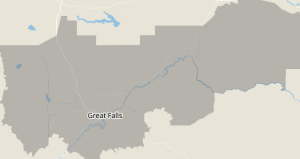
 A Winter Storm Watch with freezing rain has been issued by the National Oceanographic and Atmospheric Administration (NOAA) — a wintry mix is expected, including snow and freezing rain for areas including Eastern Pondera and Eastern Teton Counties, the Southern High Plains, Western and Central Chouteau County, Bears Paw Mountains and Southern Blaine, and Cascade County below 5000ft.
Total ice accumulations are expected up to a tenth of an inch, with localized ice accumulations up to a quarter inch.
The Winter Storm Watch will remain in effect for our area from this morning, Wednesday 12-24-2025 until Thursday morning 12-25-2025.
Freezing Rain
Freezing rain is a type of precipitation that falls from the clouds as liquid raindrops but freezes upon contact with surfaces that are at or below freezing temperatures (0°C or 32°F), forming a glaze of ice.
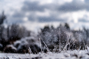 This occurs when snowflakes or ice particles high in the atmosphere melt as they pass through a layer of warmer air, turning into rain, but then encounter a shallow layer of subfreezing air near the ground that’s not deep enough to refreeze the drops before they hit the surface.
The raindrops are often supercooled (remaining liquid below freezing point) until impact, leading to rapid icing on roads, trees, power lines, and other objects.
It’s distinct from sleet, which freezes into ice pellets while still in the air before reaching the ground, and from regular rain, which doesn’t freeze on contact.
Freezing rain can lead to hazardous conditions like ice storms when accumulation is significant, causing slippery surfaces and potential damage from ice weight.

